
Lake Baikal
 At the 76 kilometre point of the Round–Baikal railroad.
When kayaking on Baikal, the last thing you think of is that beneath you is 20% of the world's cleanest freshwaters...
In this section, general information on the lake is presented with links to pages in The Magic of Baikal where you can find more detail. When gathering information, I found that it varies from one source to another, sometimes quite considerably. For example, there is still not one opinion as to the number of islands in Baikal, or the number of rivers flowing into the lake, and so on. The origin of the names of capes, islands, inlets and other sites are often a mystery. I have tried to take information from reliable sources, and indicate discrepancies with reasons for them.
The Geography of Lake Baikal
Lake Baikal is in the south of East Siberia. In the form of a new moon, Baikal stretches from south–west to north–east between latitudes
The surface area of the lake, when its water level is 454 m above sea level, is 31470 square kilometres. The maximum depth of the lake is 1637 m and average depth¬Ý‚Äî 730 m. Some sources state that the maximum depth is 1642 m. Which is correct? The answer to this question is somewhat paradoxical¬Ý‚Äî they are both correct. The thing is that the telemetry error for such depths is about 2%, i.e. 30 metres. So really it is correct to say that, at its greatest, Baikal is 1640 m deep.
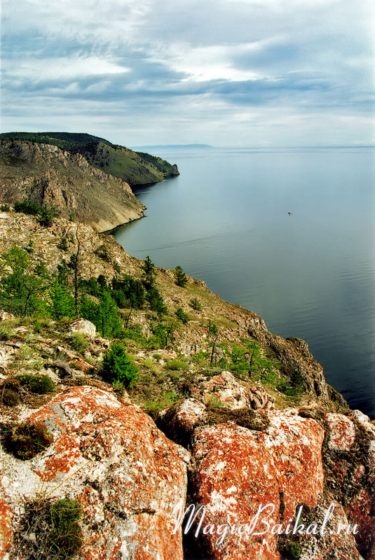
 Autumn at the Round–Baikal railroad.
336 permanent rivers and streams flow into Baikal, with half the incoming waters brought by the Selenga. Only one river flows out of the lake, the Angara. However, the question about the number of rivers flowing into the lake is rather controversial. It is more likely that there are fewer than 336. There is no doubt that Baikal is the deepest lake on Earth, its closest rival being Lake Tanganyika, a whole 200 metres behind. The lake has 30 islands, though, as has been said already, opinions on this differ. The largest of them is the Island of Olkhon.
The age of Lake Baikal
 Lake Baikal. Sunset at Cape Birakan.
In literature, the age of the lake is usually given as 20‚Äì25 million years. In actual fact, the question of its age should be considered open, as the application of different methods of determining age give from 20‚Äì30 million to a few tens of thousands of years. It would seem that the first estimate is closer to the truth¬Ý‚Äî Baikal is really a very ancient lake. If one accepts that Baikal is actually some tens of millions of years old, then it is the oldest lake on Earth.
It is thought that Baikal came about as the result of tectonic forces. Tectonic processes occur to this day, as seen by the high seismic activity of the Baikal region.
Origin of the name
Many works of literature have been devoted to the question of the origin of the word ¬´Baikal¬ª, indicating a lack of certainty in this regard. There are some ten possible explanations for the origin of this name. Amongst them, the most likely is thought to be the version that the lake's name comes from the Turkic language's Bai‚ÄìKul¬Ý‚Äî rich lake. Of the remaining versions, perhaps two should be mentioned: from the Mongolian Baigal¬Ý‚Äî rich fire and Baigal Dalai¬Ý‚Äî big lake. The people living on the lake's shores named it each in their own way. For example, the Evenk called it Lamu, the Buryats¬Ý‚Äî Baigal‚ÄìNuur, and even the Chinese had a name for Baikal¬Ý‚Äî Beihai¬Ý‚Äî Northern lake.
 Northern tip on the Island of Olkhon from the top of Cape Sagan–Khushun.
Northern tip on the Island of Olkhon from the top of Cape Sagan‚ÄìKhushun.The Evenk name Lamu, or Sea was used for a few years by the first Russian explorers in the 17th century, then they changed to the Buryat¬Ý‚Äî ¬´Baigal¬ª, and subsequently ¬´Baikal¬ª by means of a phonetic substitute slightly softening the letter ¬´g¬ª. Baikal is quite often called a sea, simply out of respect, because of its turbulent spirit, or because its far shore is often hidden in mists... At the same time, a difference is made between the Maloye Morye (Small Sea) and the Bolshoye Morye (Big Sea). Maloye Morye is the part situated between the northern shore of Olkhon and the mainland, all the rest is the Bolshoye Morye.
Baikal's water
Baikal's water is unique and surprising, as is the lake itself. It is unusually transparent, pure and saturated with oxygen. In not so distant times it was considered to have curative properties, and was used as a remedy. In spring the transparency of the lake's water, as measured by a Sekki disc (a white disc, 30 cm diameter), is 40 metres (for comparison, in the Sargasso Sea, which is considered to be the standard of transparency, there is a transparency of 65 metres). Later, when a mass algal bloom occurs, the water's transparency decreases, but in still weather one can see through to the lake floor to a considerable depth from a boat. This high degree of transparency is explained largely by the fact that Baikal's water has a low mineral content and is close to distilled water, thanks to the activity of the organisms living in it.
The volume of the lake's water is some 23 thousand cubic kilometres, which is 20% of the world's and 90% of Russia's freshwater resources. Each year Baikal's ecosystem produces some 60 cubic kilometres of clear, richly oxygenated water.
Climate
 Lake Baikal in winter.
The climate of East Siberia is acutely continental, but the enormous mass of water in Baikal and its mountainous surroundings create an unusual microclimate. Baikal acts like a large thermo‚Äìstabilizer¬Ý‚Äî in winter it's warmer at Baikal, and in summer cooler, for example, than in Irkutsk, some 70 km away from the lake. The difference in temperature is usually around 10 degrees. The forests covering almost the entire coast of Baikal make a considerable contribution to this effect.
Baikal's influence is not limited to temperature regulation. Because of the fact that there is very insignificant evaporation from the cold surface waters, clouds cannot form above the lake. Also, the air masses bringing clouds from the land, become warmer when tumbling over the coastal mountains and disperse. As a result, the sky over the lake is more often than not clear. This is confirmed by statistics: in the Olkhon area, there are some 2277 hours of sunshine a year (for comparison, the coast near Riga has 1839, and Abastumani in the Caucasus¬Ý‚Äî 1994). Of course, one shouldn't imagine that the sun is always shining over the lake, if you are not lucky, you can find yourself in one, and even two weeks of dreadfully rainy weather even in the sunniest place at Baikal¬Ý‚Äî Olkhon, but that is very rare.
The average annual temperature of the water at the surface of the lake is
Wind and waves
 Baikal's shore near the mouth of the river Talovka.
There is almost always some wind at Baikal. More than thirty names of winds are known. But this doesn't in the least mean that there are that number of different winds, only that many of them have more than one name. The peculiarity of Baikal's winds is that they almost all, almost always blow along the shoreline, and there aren't as many havens from them as one would like.
The prevailing winds are the north‚Äìwesterly, often called 'mountain' winds, north‚Äìeasterly (Barguzine and Verkhovik¬Ý‚Äî the Angara) south‚Äìwesterly (Kultuk), and south‚Äìeasterly (Shelonnik). The maximum wind speed recorded at Baikal was 40 metres a second. In literature it is possible to find even higher values, up to 60 m/sec, but there are no reliable witnesses to this.
Where is wind, there are waves, of course. I should add though, that the opposite is not true¬Ý‚Äî there can be waves even without any wind. Waves can reach 4 metres at Baikal. Sometimes it is said they can reach 5 or even 6 metres, but that is more likely an approximate estimate 'by eye', usually erring on the side of exaggeration. The height of 4 metres has been measured instrumentally in the open sea. Choppiness is more often in autumn and spring. It is rare in summer, when it is often calm.
Currents
 View from Rytyi Cape towards the Shartlay Cape.
As in any sea, in Baikal there are currents. These are brought about by a number of factors: fluctuations in atmospheric pressure, winds, the currents of inflowing rivers, and the so–called Coriolis force.
The speed of the current is only a few centimetres a second, seldom rising to more than 10 cm/sec. This depends on a number of factors and decreases with distance from the shore and with depth.
The surface current near the western shores of Baikal is almost always moving from north to south, while on the eastern coast it flows from south to north. In other words, in general, Baikal's coastal current moves anticlockwise. There is also a current along the coast of the island of Olkhon. With the exception of the straits¬Ý‚Äî Olkhonskiye Vorota (tr. the Olkhon Gates) and close to the island itself, it moves in a clockwise direction. In the Olkhonskiye Vorota straits and near the western shores of the Maloye Morye the current is so strong that in calm weather the drift of a vessel is clearly noticeable.
Animal and plant life of Baikal
 View from the top of Sagan–Zaba cliff.
There are more than 2600 species and varieties of animal and over 1000 species of plants in Baikal. From time to time new species are discovered. There is reason to believe that at present only some 70–80% of Baikal's living organisms are known to science. In former times, when Russian science was not yet in its present state of coma, on average some 10 species were discovered annually. About 40% of the plants and 85% of animal species inhabiting open Baikal are endemic, that is, they are found only in Baikal. Living organisms are distributed right from the surface of the lake to its very deepest parts.
There are 58 species of fish in the lake. The best known being omul, white‚Äìfish, grayling, huchen (salmon trout), sturgeon, ¬´golomyanka¬ª¬Ý‚Äî the Baikal oilfish, and ¬´lenok¬ª, a fish of the salmon family. Some 2000 species of plant grow on Baikal's shores, and 200 species of bird nest there. A typically marine mammal, the unique Baikal seal or nerpa, is found here. It is suggested that it came here from the Arctic Ocean along the rivers Yenisei and Angara. Its present population numbers a few tens of thousands. It can bee seen quite frequently in summer in the central and northern parts of the lake.
© Magic Baikal